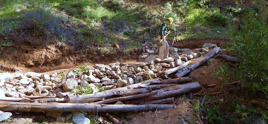
Some Of The Trails That We Work On
The Restoration Legacy Crew have worked on Grizzly Flat, George's Gap, World of Chaparral, Pines, Nature's Canteen, Trail Canyon Road, Millard Canyon waterfall, and Dawn Mine.
We have also worked to a lessor extent on Vogel Flats.
- Dawn Mine: From the I-210
Foothill Freeway in Pasadena, exit at Lake Avenue. Drive north (toward the
mountains) for 3.5 miles to the end of Lake Avenue.
Turn left (west) on Loma Alta Drive and drive 1.0 mile to Chaney Trail (marked by a blinking yellow light). Turn right and drive north on Chaney Trail. You'll pass through a gate that is locked from 8:00 p.m. to 6:00 a.m.
After a winding 1.1 miles you reach Sunset Ridge. There is marked parking near the fire road gate. The trail has been fully restored!
- Trail Canyon Road: Take 210 freeway
heading towards Sunland. Take Sunland Blvd. exit and head north.
Sunland Blvd. becomes Foothill Blvd. Drive about half a mile and turn left on Oro Vista Avenue. Continue on Oro Vista Ave through residential area past several stop signs. Oro Vista Ave curves to the right and become Big Tujunga Canyon Road.
Follow Big Tujunga Canyon Road for about 3.4 miles (past Mt. Gleason Ave intersection) and look for dirt road with a gate leaving the main road to the left. There is no obvious sign for Trail Canyon, but the turnoff is between red and white mile posts labeled "2.01" and "2.05". If you see Ottie Road, you have gone too far.
Drive in this dirt road about 1/4 mile to parking area.
- Millard Canyon Waterfall: Getting to the Trailhead:
From the I-210 Foothill Freeway in Pasadena, exit at Lake Avenue. Drive
north (toward the mountains) for 3.5 miles to the end of Lake Avenue.
Turn left (west) on Loma Alta Drive and drive 1.0 mile to Chaney Trail (marked by a blinking yellow light). Turn right and drive north on Chaney Trail. You'll pass through a gate that is locked from 8:00 p.m. to 6:00 a.m.
After a winding 1.1 miles you reach Sunset Ridge. Turn left and drive 0.5 mile down to the large parking lot. A National Forest Adventure Pass is required to park.
- Grizzly Flat: Hoyt Mountain
Road pullout (a bit south of mile marker 30.65) off of Angeles Crest Highway.
- George's Gap: George's Gap
pullout (near mile marker 32.82) off of Angeles Crest Highway
- Nature's Canteen: Clear
Creek Information Center - From 210 freeway exit at Angeles Crest Highway
(Hwy 2) and go north to the Clear Creek Station. Clear Creek Fire Station
is at mile marker 33.80. Clear Creek Information Center is across the street
from the fire station
- Pines Picnic area: From 210
freeway exit at Angeles Crest Highway (Hwy 2) and go north to the Clear Creek
Station. Clear Creek Fire Station is at mile marker 33.80.
Turn left on Angeles Forest Highway and drive about half mile to the Pines Picnic trail head parking (left side of the road) - just beyond the Pines Day Use parking.
If you need directions to other work areas, please use Google or EMail us!
The Restoration Legacy Crew updates this web site periodically and there is no guarantee that the information provided on this web site is accurate or up-to-date despite our efforts to check and verify the information provided. If you find anything to be inaccurate on this web site, please email us.